logo logo
Partners in Geospatial and CAD Services
  • About Us
    • Vision
    • World Wide Services
    • Leadership
    • Life@I-Tech Lance
    • Our Team
    • Market We Serve
    • Office & Location
  • Our Capabilities
    • CAD Conversion and Drafting
    • Point Cloud To CAD
    • GIS
    • Photogrammetry
    • LiDAR
    • Remote Sensing
    • Utility Mapping
    • BIM
    • 3D visualization
  • Reference
    • CAD Conversion and Drafting
    • Point Cloud To CAD
    • GIS/Photogrammetry/LiDAR/ Remote Sensing
    • Manhole
    • Utility Mapping
    • BIM
    • 3D visualization
    • Marketing Floor Plan
  • Career
  • Contact Us

  Recent News

  • Employee Engagement Activity | iTechLance IT
  • Celebrating Tradition & Leadership at Itechlance
  • Employee Engagement Activity | iTechLance IT Pvt. Ltd!!!
  • Employee Engagement Activity at iTechlance!
  • Raja Celebration at iTechLance 2025

Employee Engagement Activity at iTechlance!

Post by: iTechLance Created Date: 08th Jul 2025
Employee Engagement Activity  at iTechlance!
Employee Engagement at iTechlance!!
The session was all about inspiration and growth! 
Our team came together to share personal stories that motivate and uplift — showing the true spirit of teamwork and resilience. 

Lively discussions followed on skill development and future goals, with everyone actively contributing ideas and support. 
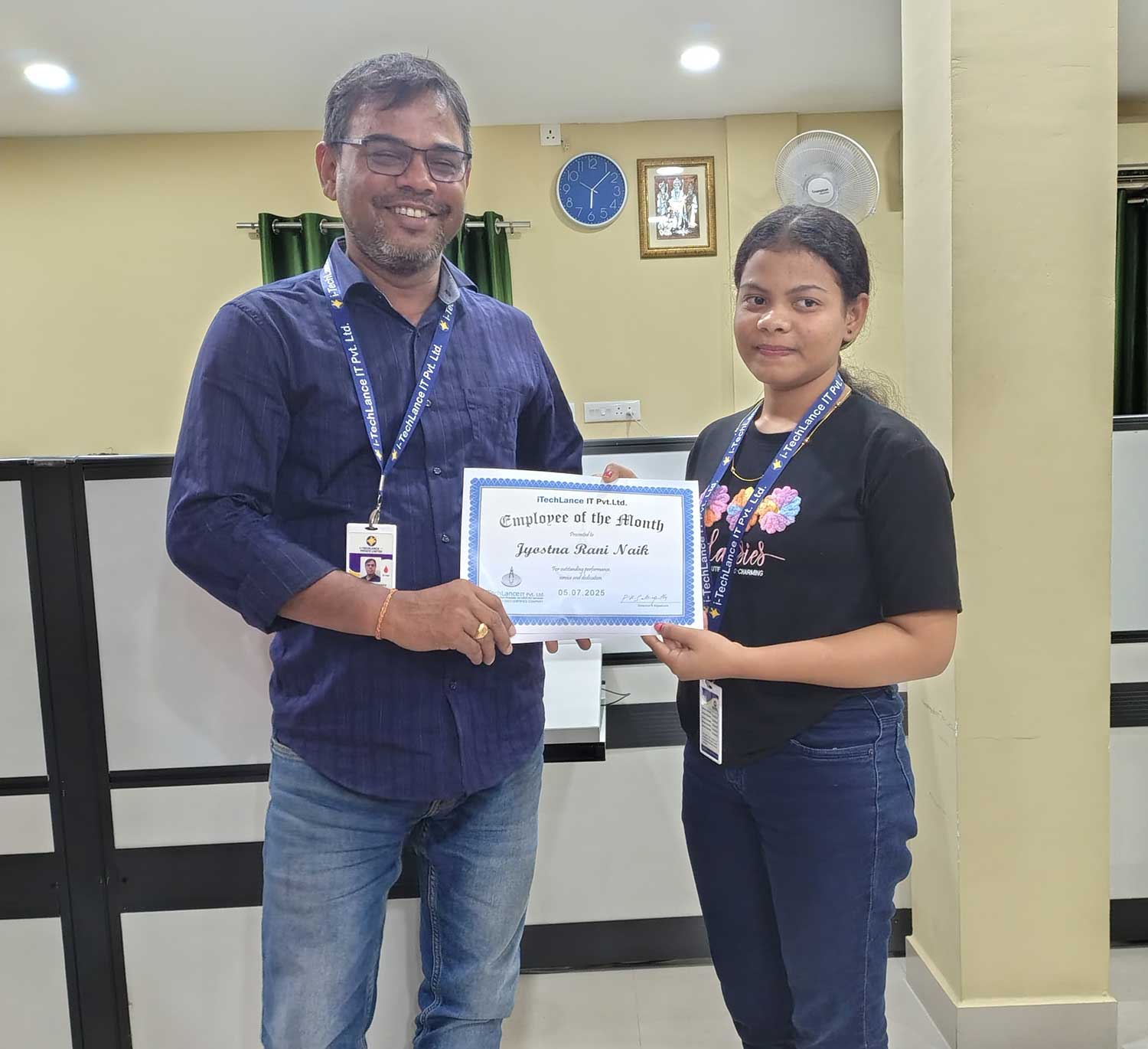
We ended on a high note by honoring our Employee of the Month; June
Her hard work truly shines!


#iTechlance #TeamTalks  #EmployeeEngagement  #GrowthTogether  #EmployeeOfTheMonth
About Us

iTechLance IT is a leading global provider of GIS, CAD, BIM, Photogrammetry, LiDAR, Remote Sensing, and Utility Mapping services, delivering cutting-edge geospatial and IT solutions to clients across the world. Headquartered in Bhubaneswar, India, with delivery centers and global partnerships, iTechLance has been empowering businesses for over 25 years with precision, innovation, and reliability.
Our team of 125+ skilled professionals combines technical expertise with domain knowledge to deliver end-to-end services that support industries such as utilities, telecommunications, real estate, architecture, engineering, construction, and government agencies.

Services We Provided

  • CAD Conversion and Drafting
  • GIS
  • Photogrammetry
  • LiDAR
  • Remote Sensing
  • Utility Mapping
  • BIM
  • 3D visualization

Reference

  • CAD Conversion and Drafting
  • Point Cloud To CAD
  • GIS/Photogrammetry/LiDAR/ Remote Sensing
  • Manhole
  • Utility Mapping
  • BIM
  • 3D visualization

Copyright © Itechlance. All rights reserved

Privacy Policy|Terms & Conditions|Data Protection